
About the Axe catchment
The River Axe rises in Dorset, forms the boundary between Devon and Somerset, and flows through East Devon for much of its length, reaching the sea at Axmouth, just east of Seaton.
The River Axe rises in Dorset, forms the boundary between Devon and Somerset, and flows through East Devon for much of its length, reaching the sea at Axmouth, just east of Seaton.
The catchment comprises approximately 450 square kilometres (174 square miles) of East Devon, West Dorset and Somerset. The main river is around 35 km long with the source lying just south-east of the village of Chedington, which also hosts the source of the River Parrett, which flows north through Somerset and into the Bristol Channel.
From Chedington, the river flows north-west and then west to Axminster, joined by the Kit Brook and the Blackwater as well as smaller streams. Just west of Axminster it is joined by its largest tributary, the south-flowing River Yarty, and then flows south-west to the sea and is joined at the top of the estuary by the River Coly.
It is important to understand the ‘administrative geography’ of the Axe. The Environment Agency (EA) and Natural England are the principal bodies responsible for the protection and enhancement of the environment in England.
In terms of river and catchment management they place the Axe within the Lim and Axe Operational Catchment on the eastern edge of the East Devon Management Catchment. This also includes the rivers Creedy, Exe, Clyst, Culm, Otter and Sid. Each Operational Catchment is divided into constituent waterbodies – the Lim and Axe contains 13 waterbodies in total – 11 of which drain into the estuary.
These are the Upper and Lower Coly, Offwell Brook, Umborne Brook, Corry Brook, River Yarty, Kit Brook, Forton Brook, Blackwater River and the Upper and Lower Axe. This ‘administrative geography’ provides the framework under which the EA and NE assess and report on the river and stream health.
For most of its course the Axe flows briskly but gently, with short riffles separating gently flowing pools. There are floods every year, mainly but not exclusively in autumn and winter, when the river spreads over its floodplain and blocks most crossings between Axminster and the sea. In its upper reaches the underlying geology is varied, with the bedrock being limestone or calcareous sandstone; in the lower reaches it flows over mudstones or alluvium. The water is therefore neutral to mildly alkaline and base-rich.
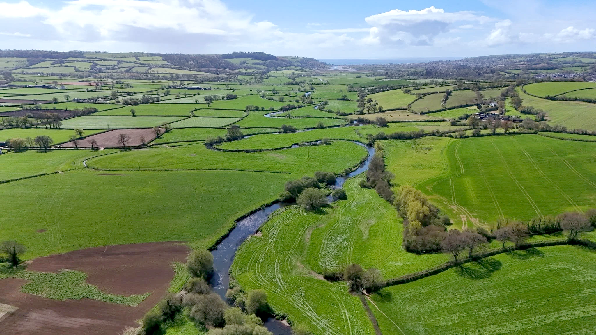
The river between Axminster and the sea seems too small for the wide valley and it has been suggested that the valley is a glacial overflow channel formed by the overflowing, through the Chard Gap, of a glacial lake (Lake Maw) in the upper Bristol Channel, penned in by ice moving south from the Welsh hills.
The main town on or close to the river is Axminster, but there are numerous small villages and farms scattered along the edge of the flood plain. Water for domestic use is no longer sourced from the river but is piped in, mainly from Wimbleball Reservoir in Somerset. Away from settlements, the river flows almost entirely through agricultural land, mainly dairy farms with grazing land near the river and fields of fodder maize and grass for silage further away, off the flood plain.
The River Axe is designated as a Site of Special Scientific Interest (SSSI) under the Wildlife and Countryside Act 1981 and as a Special Area of Conservation (SAC) under the Conservation of Habitats and Species Regulations 2010. The SSSI extends from the junction with the Blackwater Stream at Broom, north-east of Axminster, to the tidal limit at the A3052 bridge near Boshill Cross. The reasons for designation include the good quality and varied lowland river habitats, as well as the geomorphological feature of a lowland river meandering freely in its flood plain.
However, assessment in 2011 led to the SSSI being rated as in unfavourable condition and declining. Important fish species mentioned in the designation include Atlantic Salmon, Brown Trout, Sea Trout, Bullhead, Brook Lamprey and Sea Lamprey. Otter, Water Vole, White-legged Damselfly and Medicinal Leech are among other animals mentioned, and Short-leaved Water Starwort is an uncommon water plant that has a stronghold here among the beds of Water Crowfoot and pondweeds.
Himalayan Balsam is an invasive alien plant found throughout the catchment and particularly along the riverbanks.
The fauna of the river and catchment has changed considerably in the last 50 years. A trap at the tidal limit that operated in the 1960s suggested an annual run of hundreds of Salmon and thousands of Sea Trout. Now the figures are a tenth of this at best. Tagging at the trap showed that Axe Salmon joined others to feed off Greenland and returned to the Axe, while tagged Sea Trout were recaptured in many Devon rivers and even as far north as the Tweed. Records from the trap make little mention of Mullet but they are now common in the river in summer, sometimes reaching Axminster.
Otters were rare at that time but are now frequent but elusive throughout the catchment. Mink appeared while the trap was in operation and persist in reduced numbers, thanks to targeted trapping. Water Voles were formerly widespread but were probably exterminated by Mink; they have been reintroduced to the lower reaches. Little Egrets colonised the estuary in the 1960s and bred from about 2007. Nesting Lapwings, Skylarks and Yellowhammers were recorded from the floodplain in the 1980s but are now absent as breeders; Redshank last bred in 2013. River plants are now less abundant than formerly and there are fewer species.
by Mike Lock, a retired botanist and ecologist who has lived in the Axe Valley for the past 22 years.